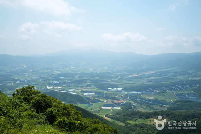
![Hantangang River [National Geopark] (한탄강(국가지질공원, 고석정))](http://tong.visitkorea.or.kr/cms/resource/52/2675252_image2_1.jpg)
Hantangang River [National Geopark] (한탄강(국가지질공원, 고석정))
Gangwon · 1825 , Taebong-ro, Cheorwon-gun, Gangwon-do
Address
1825 , Taebong-ro, Cheorwon-gun, Gangwon-do
1825 , Taebong-ro, Cheorwon-gun, Gangwon-do
Overview
Goseok Rock, located in the area of Hantangang River, is a granite rock that reach 15 meters in x_height. The area is often called Goseokjeong, named after the nearby Goseokjeong Pavilion. The area is an important geology and topography learning site where it is visible to see the topography before the formation of the basalt lava field and the fact that the basalt lava flowed over the bedrock to form the lava field. Goseok is a bedrock that existed before the area of Cheorwon was covered with lava, and is a granite formed underground about 110 million years ago (mid Cretaceous period). It is covered in basalt lava by volcanic activity that occurred between about 540,000 and 120,000 years ago, and then eroded by the Hantangang River to form a new waterway.
Location
📍 Open in Google MapsHow to Get There
Info: • 1330 Travel Hotline: +82-2-1330 (Korean, English, Japanese, Chinese) • For more info: +82-33-450-4810
Best Time to Visit
South Korea has four distinct seasons. Spring (March–May) and autumn (September–November) are the most popular times to visit. Summer brings humidity and occasional typhoons, while winter is cold but great for ski resorts and festivals.
Frequently Asked Questions
Security tour does not operate on Tuesdays and during Seollal (Lunar New Year's Day) & Chuseok (Korean Thanksgiving Day) holidays
• 1330 Travel Hotline: +82-2-1330
(Korean, English, Japanese, Chinese)
• For more info: +82-33-450-4810
(Korean, English, Japanese, Chinese)
• For more info: +82-33-450-4810
Photos
![Hantangang River [National Geopark] (한탄강(국가지질공원, 고석정))](http://tong.visitkorea.or.kr/cms/resource/54/2609754_image2_1.jpg)
![Hantangang River [National Geopark] (한탄강(국가지질공원, 고석정))](http://tong.visitkorea.or.kr/cms/resource/50/2675250_image2_1.jpg)
![Hantangang River [National Geopark] (한탄강(국가지질공원, 고석정))](http://tong.visitkorea.or.kr/cms/resource/51/2675251_image2_1.jpg)
© Korea Tourism Organization · Source required · No modifications