![Korean Peninsula Terrain [National Geopark] (한반도지형 (강원고생대 국가지질공원))](http://tong.visitkorea.or.kr/cms/resource/57/2517657_image2_1.jpg)
Korean Peninsula Terrain [National Geopark] (한반도지형 (강원고생대 국가지질공원))
Gangwon · 555 Hanbando-ro, Hanbando-myeon, Yeongwol-gun, Gangwon-do
Hours
Open 24 hr
Open 24 hr
Address
555 Hanbando-ro, Hanbando-myeon, Yeongwol-gun, Gangwon-do
555 Hanbando-ro, Hanbando-myeon, Yeongwol-gun, Gangwon-do
Parking
Available
Available
Overview
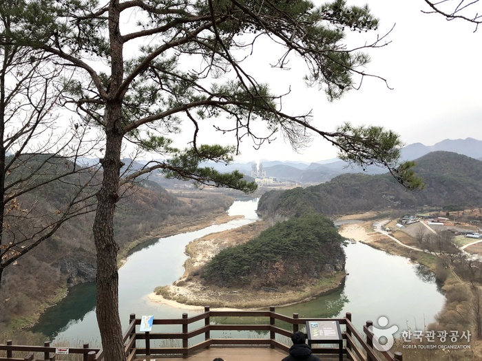
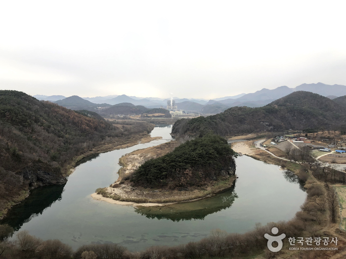
Korean Peninsula Terrain was formed by soil transported from upstream to the curvature of the confluence of two rivers. It is often referred to as Mini Korean Peninsula because it resembles the shape of the Korean Peninsula. It is said to have this appearance due to the erosion of the incised stream flowing around the terrain. It takes a 15-minute walk along the pine forest trail for about 800 meters from the parking lot to reach there. The well-maintained trail with many wildflowers and plants creates a welcoming atmosphere. Upon arriving at the observation point, visitors will be amazed by the beautiful curved river and the topography taking the same shape as the Korean Peninsula. Designated as the Gangwon Paleozoic National Geopar, this area has excellent geographical value because it shows the characteristics of the incised mender river as well.
Location
📍 Open in Google MapsHow to Get There
Info: +82-33-560-2379
Best Time to Visit
South Korea has four distinct seasons. Spring (March–May) and autumn (September–November) are the most popular times to visit. Summer brings humidity and occasional typhoons, while winter is cold but great for ski resorts and festivals.
Frequently Asked Questions
Open 24 hr
Available
N/A (Open all year round)
+82-33-560-2379
Photos

© Korea Tourism Organization · Source required · No modifications